Monday, August 18, 2008

The Perfect Escape from a Heat Wave in the City

Pictures courtesy of Aaron Smith, fellow hiker.

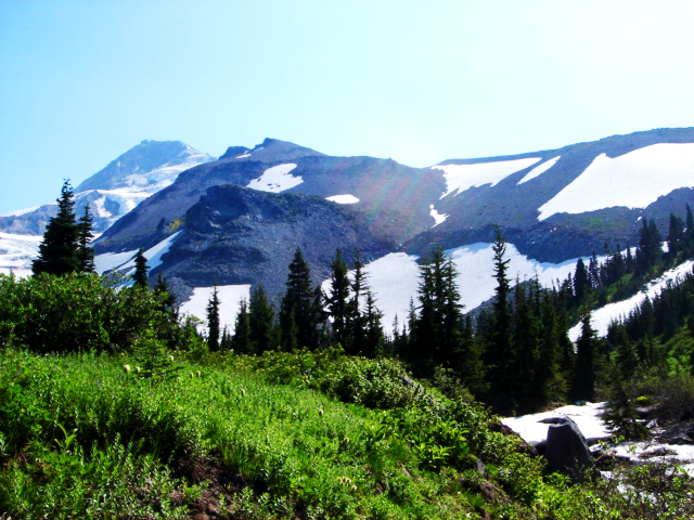
The original plan was to climb up Gnarl Ridge. Alas, a forest fire closed down every ridge line leading up to this area of the mountain. So we switched gears and headed up Elk Cove Trail #631.


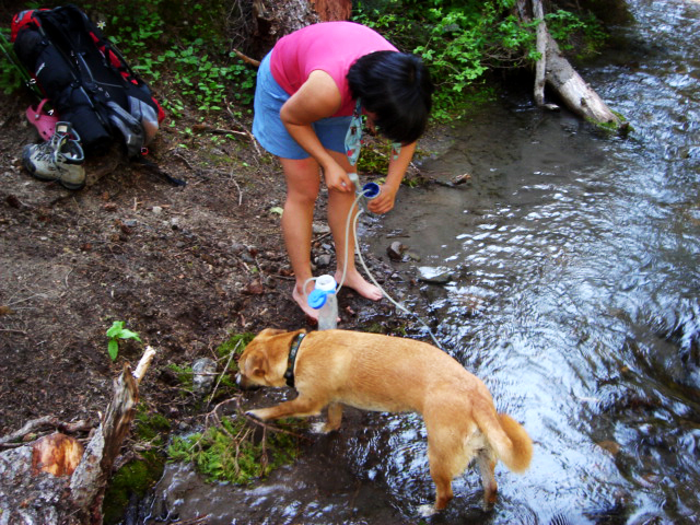
Two creeks strategically placed about 3.5 miles apart were welcome spots to cool off on such a HOT day in Oregon.


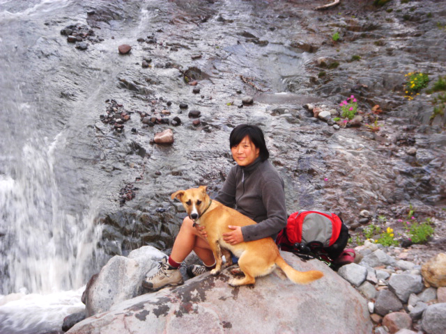
From Elk Cove, we went on two mini-hikes along the Timberline Trail #600. The first went west in search of the illusive Dollar Lake, which we never managed to locate due to snow covering the trail. The second was east to Coe Falls, which were quite full from melting snow.


The best show in town was the wildflower display in the meadows of Elk Cove. Too fearful of rain, I left my camera at home. Looks like a day hike is in order to capture the meadows in all of its alpine summer glory!

Thursday, August 14, 2008

Horseshoe Ridge Trail #774

Not the most amazing hike in Mt. Hood National Forest, but the view at the top is kinda spectacular. Just a few rogue clouds, so I was able to see Mt. St. Helens, Mt. Adams, Mt. Hood (of course) and Mt. Jefferson. The best part was the wildflower display...

Trail is a gentle slope of continuous uphill. Plenty of shade, but no water source. Also, this trail is shared with horses.

Would have liked to looped into Cast Creek Trail #773 via Zigzag, but time did not permit as it adds another two miles...there's always next time!

Click on any image to view full-size

trail junction


Mt. Hood


cascade lily


indian paintbrush, lupine, and yellow wildflowers

Sunday, August 10, 2008

What do people and weather have in common?

They're both unpredictable!

This weekend, I had two day hikes planned. In reality, I ended up strolling around Sauvie Island on Saturday (blackberries are ripe for the picking) and Sunday turned into a half-hike (aka scouting expedition).

Click on any image to view full-size

Here's the first of several trail junctions to mark the way to Cairn Basin via Vista Ridge. Got a late start and most hikers who I encountered were heading home. Received several warnings about snow on the trail, but Max and I were feeling confident.


Though the trail along Vista Ridge was easy, the ascent to Barrett Spur looked "iffy". Note the right side of the picture is Mt. Hood's peak hiding behind an ominous cloud.


I opted to admire the avalanche lily-covered slopes and snack on my homemade blackberry scones.


Several hikers warned me that the loop trail to Cairn Basin was easy to lose due to the snow coverage. But I had to try...and, indeed lost the trail. Unable to complete the loop, I headed back out trying not to sulk.


Hood heard my plea and finally unveiled herself as I drove away from the trailhead.

Sunday, August 3, 2008

My love for wildflowers has been renewed...

by a trail called Grassy Knoll

click on any image to view full-size